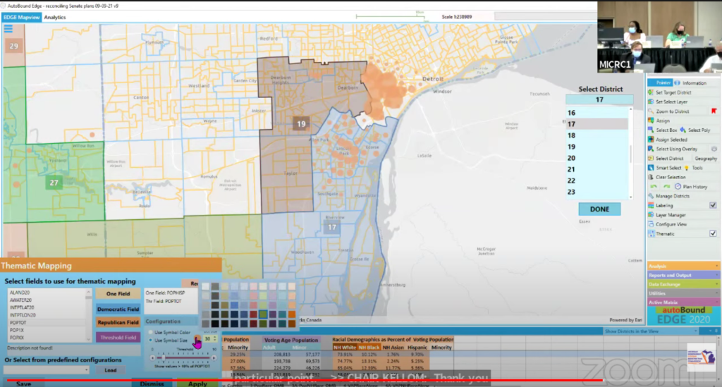
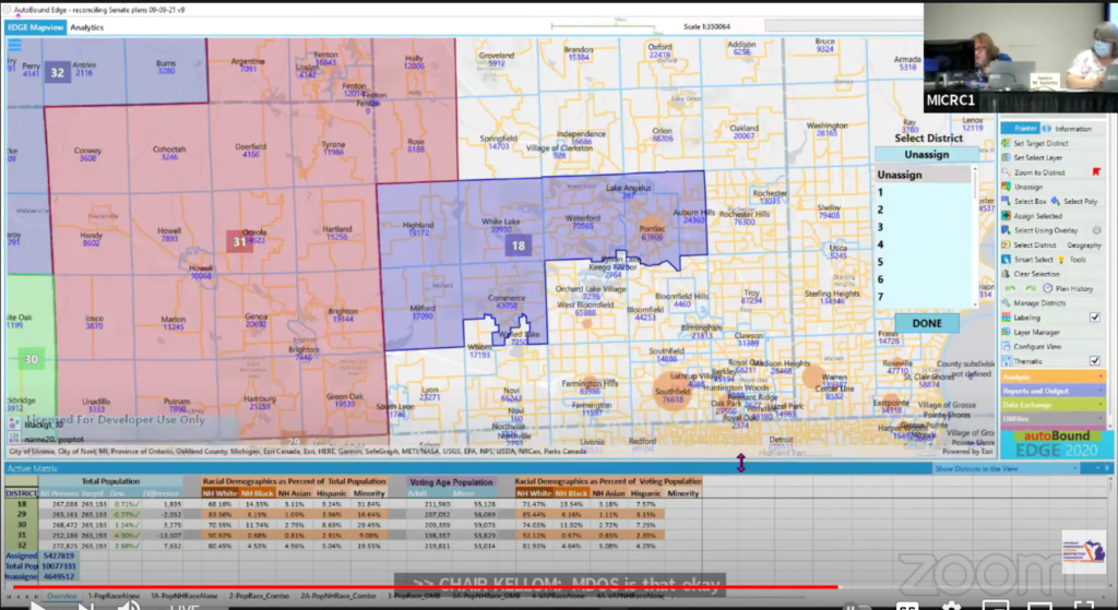
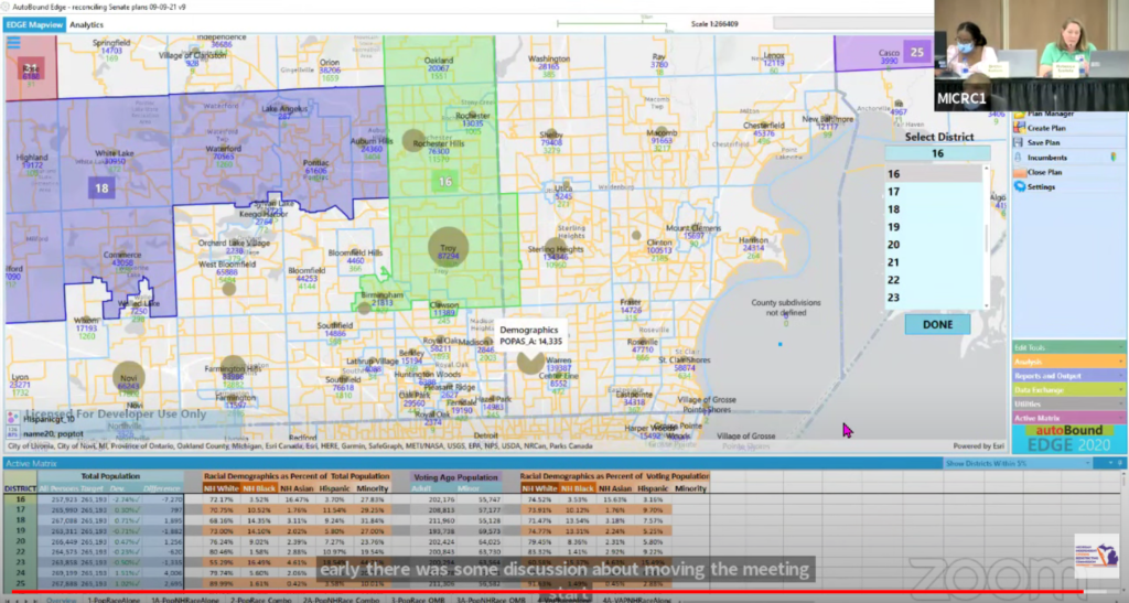
The Michigan Independent Citizens Redistricting Updates Blog
A volunteer-powered blog to keep you informed on the latest MICRC updates
The Michigan Independent Citizens Redistricting Commission has voted to approve the Chestnut Congressional plan via a roll-call vote. The commissioners who approved this plan include Clark (R), Eid (N), Kellom (D), Lett (N), Orton (R), Vallette (N), Weiss (N), and Witjes (D). The commission will continue to discuss the State House and State Senate maps […]
Read More >>>The MICRC has concluded its collaborative mapping process today prior to the 45-day public comment period, developing 3 State Senate, 3 State House, and 3 Congressional district maps. Michiganders can view and download the proposed maps here. In addition, the commission will meet next Monday, November 8th, from 10 AM – 4 PM to discuss […]
Read More >>>The commission voted today to advance two more State House maps named “Magnolia” and “Hickory” for the 45-day public comment period, after voting last night to advance the 5th version of the “Pine” map. A merged version of the “Pine” Version 3 and “Pine” Version 5 maps, Magnolia includes changes such as keeping Albion and […]
Read More >>>Following public comment from the ICRC’s second round of public hearings, the commission spent today making edits to State House districts in major cities such as Grand Rapids, Lansing, and Flint. Making a third clone of the “Pine” map, the commission made adjustments to districts in Grand Rapids and split Lansing into five districts as […]
Read More >>>During today’s meeting, the Commission began with making edits towards their State House Maps. Making a copy of their “Pine” map, commissioners separated Midland from Bay City and made edits in Detroit districts to ensure neighborhoods were kept whole. The commission made another version of the “Pine” map after the lunch break to address more […]
Read More >>>The commission today voted to submit its first State Senate map, the “Cherry” map, for the 45-day public comment period after a series of final edits. Afterward, commissioners then deliberated on which Congressional maps to move forward, deciding on editing the “Apple” and “Birch” maps, as well as Commissioner Eid’s map (now referred to as […]
Read More >>>The commission continued their deliberations regarding their State Senate draft maps as they edited their “Cherry” map to achieve partisan fairness. They made amendments towards metro Detroit districts to respect AAPI communities in Troy, Rochester Hills, and Sterling Heights and split Ann Arbor into two districts. Following their lunch, they connected Ada and Cascade Townships […]
Read More >>>Following their statewide public hearing tour, the Commission reconvened in Lansing this week to begin their deliberations based on responses toward their maps. They began today by reviewing the most common public comments they have received in Detroit, Lansing, Grand Rapids, Gaylord, and Flint. Afterward, they began evaluating collaborative and individual maps to determine which […]
Read More >>>Michiganders can now view and comment on the commission’s proposed collaborative draft maps via the public comment portal. By selecting Draft Plans, residents can view the 3 State House, 3 State Senate, and 4 Congressional district maps either through the portal website or through the online mapping software, Districtr. Through Districtr, viewers can also view […]
Read More >>>The commission has voted this afternoon to approve the first set of draft State House, State Senate, and Congressional district maps for the second round of public hearings beginning on October 18th. The commission approved 3 State Senate, 3 State House, and 4 Congressional district maps in total. Please keep an eye out on our […]
Read More >>>